Best Things to Do in Agumbe (2026) Top 5 at a Glance: • Watch the sunset from Agumbe Ghat’s famous viewpoint • Visit ARRS (Agumbe Rainforest Research Station) for King Cobra tracking • Trek to Kunchikal Falls India’s highest waterfall at 455 metres • Try Grade 2–3 white water rafting at Seethanadi Nature Camp • Relive Malgudi Days nostalgia at Doddamane, R.K. Narayan’s inspiration
Agumbe is not a destination you stumble upon. You choose it. This tiny village in the Shimoga district of Karnataka gets 7,000 mm of rainfall a year — the second highest in India. It’s the filming location of the legendary TV series Malgudi Days, the home of India’s only dedicated King Cobra research station, and the gateway to some of the most spectacular waterfalls in South Asia. If you’re searching for the best things to do in Agumbe in 2026, you’re looking at sunset viewpoints, rare wildlife encounters, waterfalls that will make you forget your phone, and a spiritual detour to a 1,200-year-old temple just 25 km away. Here’s what you need to know no fluff, all facts.
The best time to visit is July to November for waterfalls and monsoon magic. For clear sky sunsets and wildlife, December to February delivers. The village is 100 km from Mangalore and 380 km from Bangalore. Plan 2–3 nights minimum. One day won’t do it justice.
Heritage & Nostalgia Malgudi Days
Doddamane: Where Malgudi Was Born
In 1986, Shankar Nag turned R.K. Narayan’s novels into Malgudi Days, a TV series that defined a generation’s idea of small-town India. The show was filmed across Agumbe, and its emotional heart was Doddamane a 200-year-old traditional wooden house that served as Swami’s family home.
The house belongs to the Kasturi family, and Kasturi Akka the family matriarch still lives here. She is 80+ years old and welcomes visitors, but on her terms.
2026 Visiting Protocols Read Before You Go
The rules have tightened since 2023 due to overtourism and disrespectful behaviour from visitors. Follow these strictly:
- Visiting hours: 9 AM to 5 PM only. No exceptions.
- Photography: Permitted in the courtyard and outside. Do not photograph Kasturi Akka without explicit consent.
- Dress code: Traditional attire respectful. No shorts, no sleeveless inside the house.
- Traditional meals: If offered rice, sambar, and payasam on a banana leaf accept with both hands. This is not a restaurant; it’s a home. Contributions of ₹100–200 are appropriate and appreciated.
- Group size: Arrive in groups of 5 or fewer. Large tour groups are no longer welcome.
The experience is not a museum. The black-and-white photos on the walls, the wooden swing in the courtyard, the smell of sandalwood — it’s all still there. Malgudi lives here, not in nostalgia, but in daily life. Treat it that way.
The Waterfall Trail The Big Four
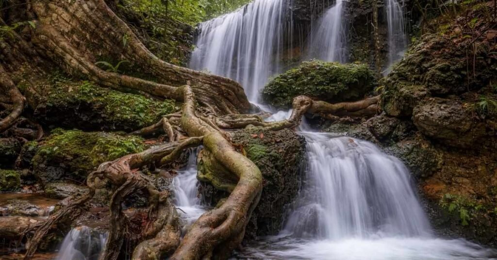
Agumbe sits at the edge of some of India’s most dramatic waterfalls. The Western Ghats terrain and the 7,000 mm rainfall create cascades that rival anything in Southeast Asia. Here’s your 2026 waterfall guide.
| Waterfall Name | Height | Trek Difficulty | 2026 Permit Fee | Best Season |
| Barkana Falls | 259 m | Moderate (4 km return) | ₹150 | July – October |
| Kunchikal Falls | 455 m (India’s Highest) | Easy–Moderate (viewpoint access) | ₹100 | July – September only |
| Onake Abbi | ~60 m | Easy (1.5 km) | ₹100 | July – November |
| Jogi Gundi | ~20 m | Easy (0.5 km) | Free | June – December |
Barkana Falls The Monsoon Giant
At 259 metres, Barkana is the tallest easily visible waterfall near Agumbe. The trek runs through dense forest inside the Bhadra Tiger Reserve buffer zone. Carry your permit (Forest Dept. office, Agumbe village, 9 AM–4 PM). The falls are at full force in August–September. In October, volume drops but the forest is greener and leech density falls.
Kunchikal Falls India’s Highest, But With a Catch
Kunchikal Falls drops 455 metres, making it India’s highest waterfall. But there’s a 2026 update you need to know: the Mani Dam hydroelectric project has permanently altered access and visibility. The dam upstream means Kunchikal is only visible in its full form during peak monsoon July to mid-September when the dam’s outflow is high enough to override the diversion. Outside monsoon, the falls reduce to a trickle or disappear entirely.
The viewpoint access trail (2 km) starts from Hulikal village. Permit required from Agumbe Forest Range Office. No entry after 3 PM.
Onake Abbi & Jogi Gundi The Hidden Gems
Onake Abbi means ‘pestle shaped’ in Kannada the falls pour through a narrow rock gap in a single powerful column. It’s 15 km from Agumbe town. Jogi Gundi is inside a forest clearing that feels like the set of a nature documentary. Both are ideal for families and first-time trekkers.
Leech Protection The Agumbe Survival Guide
This is not optional reading. Agumbe’s forest floor is leech country in monsoon. Three rules:
- Salt method: Carry a small pouch of table salt. Rubbing it on leeches causes immediate detachment without leaving head parts embedded. Do not pull.
- Leech Socks: Buy purpose-made leech socks (available at Agumbe village shops, ₹80–120). Wear them over your regular socks and tuck into boots. These are non-negotiable on the Barkana and Kunchikal trails.
- After the trek: Do a full body check at the trailhead before getting in any vehicle. Check ankles, behind the knees, and underarms. A detached leech in a car or bus seat is a problem for the next person.
Science, Snakes & Conservation ARRS & KCRE

Agumbe is home to two conservation organisations doing serious work on herpetology the study of reptiles and amphibians. They are not the same, and visiting both gives you a complete picture of what makes this rainforest globally significant.
| Feature | ARRS (Agumbe Rainforest Research Station) | KCRE (King Cobra Research & Education) |
| Primary Focus | Scientific research on King Cobras & herpetofauna | Education, awareness, and community workshops |
| Entry Fee (2026) | ₹250 per person | ₹250 per person |
| Timings | 10 AM – 5 PM (Tue–Sun) | 10 AM – 5 PM (Mon–Sat) |
| Best For | Researchers, wildlife photographers, serious enthusiasts | Families, school groups, eco-tourism first-timers |
| USP | King Cobra Radio Telemetry live data | In-depth 3-hour conservation workshops |
King Cobra Radio Telemetry The 2026 Project
ARRS’s flagship 2026 project tracks King Cobras using surgically implanted radio transmitters. Each tagged snake carries a unique frequency. Researchers use handheld receivers to locate snakes sometimes 5 km into the forest and log movement, temperature preference, and prey behaviour.
In 2026, ARRS has 8 active tagged cobras in the Agumbe landscape. Visitors can observe the tracking process at the station (no forest entry). You’ll see live telemetry data on a screen: the snake’s last recorded location, movement frequency, and seasonal territory data. It’s the closest thing to a live episode of Planet Earth that you can watch in real time.
The Night Trail Rare Amphibians After Dark
Both ARRS and KCRE offer Night Trails (8 PM – 10 PM, bookings required 48 hours in advance, ₹400/person). The Western Ghats has over 200 endemic amphibian species. On a single 2-hour walk, you can spot the Malabar Gliding Frog, purple frogs (Nasikabatrachus sahyadrensis), and multiple species of caecilians that are invisible by day. Bring a red-light torch white light disturbs amphibians.
Adrenaline & Spirit Seethanadi & Sringeri
White Water Rafting at Seethanadi Nature Camp
Seethanadi Nature Camp sits on the banks of the Sauparnika River, 42 km from Agumbe. It’s the only spot in Karnataka offering Grade 3 white water rafting — a step up from the calmer Coorg or Rishikesh beginner sections.
- Season: July 1 to October 31. The river runs best mid-July to September.
- Grade 2 section: 6 km stretch, ₹800/person. Suitable for beginners aged 14+.
- Grade 3 section: 4 km stretch with three Class 3 rapids. ₹1,200/person. Age minimum: 16. Swimming ability required.
- Gear: Life jackets, helmets, and paddles provided.
- Booking: Advance booking mandatory via Seethanadi Camp’s website or Karnataka Tourism portal. Walk-ins limited to 4 slots/day.
The camp offers forest cabins, a natural swimming pool, and guided birding walks. The dawn chorus at 5:30 AM with Malabar whistling thrushes and hornbills is something your city-softened ears will not forget.
Sringeri Sharada Peetham 25 km from Agumbe
The Sharada Peetham was established in 788 AD by Adi Shankaracharya making it over 1,200 years old and one of the four cardinal mathas of Advaita Vedanta philosophy.
- 12 Zodiac Pillars: The temple’s mandapa features 12 individually carved stone pillars, each representing a zodiac sign with its deity, animal symbol, and Sanskrit inscription.
- Vidyashankara Temple: Built in 1338 AD. Sunlight on specific days falls precisely on the zodiac pillar corresponding to that month’s sun sign. This is structural astronomy, not legend.
- Tunga River Ghats: The ghat steps in the morning, with brass lamps and chanting, is one of the most photogenic scenes in Karnataka.
Timings: 6 AM – 1 PM and 4 PM – 8:30 PM. Entry is free. No photography inside the main sanctum. Men must remove shirts before entering the inner sanctum.
Viewpoints & Sunsets Kundadri & Agumbe Ghat
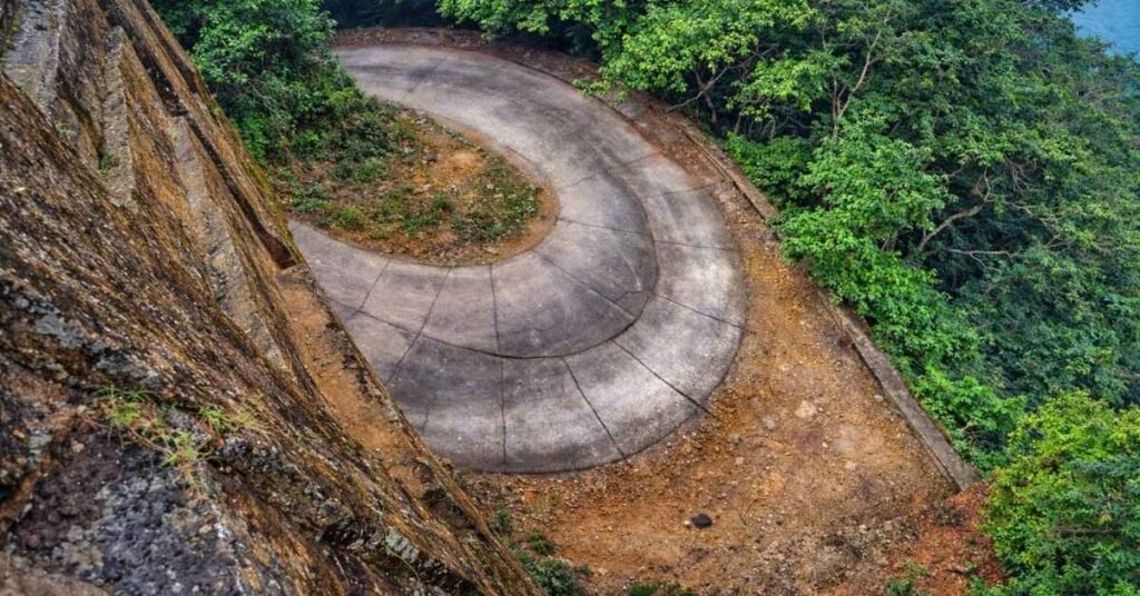
The 14 Hairpin Bends of Agumbe Ghat
The Agumbe Ghat road (NH-169A) descends 590 metres over 8 km through 14 hairpin bends from Agumbe village to the coastal plains. It’s one of the steepest ghat roads in Karnataka. In monsoon, the bends are half-covered in mist and the valley below disappears into cloud.
The Sunset Viewpoint is at the top of the first descent about 1 km from Agumbe village towards the ghat. Parking is limited to 12 vehicles. On clear days (October–February), the Arabian Sea is visible 70 km away, glinting orange at dusk. The sunset here is consistently ranked among India’s top 5 natural sunset viewpoints.
Kundadri Hill Sunrise, Jain Temple & 360° Views
Kundadri Hill (920 m) is a 9 km drive + 2 km forest walk from Agumbe. The summit has a 17th-century Jain temple dedicated to Chandranatha Swami. The stones fit without mortar and the interior stays 4–5 degrees cooler than outside.
The 360-degree view spans the Malnad plateau to the east, the coastal belt to the west, and the Western Ghats ridgeline to the north and south. On a clear morning, you can identify Kudremukh peak and parts of the Coorg range.
Narasimha Parvatha Trek: The Summit of Agumbe
Starting from Malandur Village (6 km from Agumbe), this 13 km one-way trail to a 3,800-foot summit is the hardest thing you will do in this region, full stop. The terrain shifts dramatically as you climb: dense, dark rainforest canopy for the first half, then the trees break open without warning into vast rolling grasslands near the peak, temperature dropping several degrees the moment you cross that line. From the top, the entire Kudremukh range spreads across the horizon. A mandatory Forest Department guide (₹500 guide fee + ₹200 permit) is non-negotiable here since the trail cuts through active leopard and King Cobra territory.
I broke through that tree line completely drenched, wiped the sweat off my face, and looked down to see Barkana Falls dropping into the valley directly below me. Seeing it from above, rather than from the tourist viewpoint, is a different experience entirely. The trail is open October to January only; the forest department shuts it completely during monsoon.
Koodlu Theertha Falls: The Pristine Natural Pool
Twenty kilometres from Agumbe towards Hebri, Koodlu Theertha gets a fraction of the footfall that Onake Abbi and Barkana receive, purely because the location demands effort. The 3.5 km jungle trail to the 300-foot drop is proper unmanaged rainforest, no paved paths, roots across the trail, unbroken canopy overhead. The payoff is a natural freshwater pool at the base fed directly by the Seetha River’s very first drop, which means the water is extraordinarily clean. Swimming is permitted post-monsoon, and there is a shallow cave-like formation behind the curtain of falling water worth exploring.
After a humid 3.5 km hike I was in that pool within minutes of arriving, the 300-foot roar making conversation impossible, the water cold enough to reset every complaint I had about the walk. Sitting on a boulder in the middle of that pool is one of those moments that needs no photograph to stick. Entry is ₹100 per person, gates close at 3:00 PM sharp.
Kavaledurga Fort: The 9th-Century Hill Stronghold
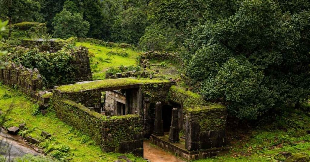
Built in the 9th century and expanded in the 14th, Kavaledurga is 15 km from Thirthahalli and rewards visitors who are willing to climb 2 km of original stone steps through dense forest. The fort reveals itself suddenly, a massive moss-covered archway appearing around a bend with no warning. Three defensive tiers of enormous stone walls, ancient freshwater ponds called Gada Theertha that still hold water year-round, and the Shikhareshvara Temple at the summit make this one of the most complete yet least crowded hill forts in Karnataka. The Varahi River backwaters visible from the top tier are worth the climb alone. Entry is free, maintained by ASI.
I walked through that first archway at 8:30 AM with mist rolling through the gaps in the walls, and had the entire lower tier to myself. The silence inside the fort compound is qualitatively different from the forest outside. It felt less like a heritage site and more like a place modern tourism had simply forgotten existed.
Gopalakrishna Temple (Kabbinale): Hoysala Architecture in the Wilderness
The Gopalakrishna Temple in Kabbinale village, 25 km from Agumbe, is a 14th-century Hoysala structure built in the Tulunadu style, and it stands in complete contrast to everything wild and unstructured around it. The stone carvings are sharp, detailed, and unweathered in the way that only genuinely cared-for heritage looks. No entry fee, no crowds, no commercial infrastructure; just a 10-minute walk from the parking area into one of the more quietly extraordinary temple courtyards in the Western Ghats.
I stood barefoot on the cool stone courtyard, the smell of old rock and burning camphor mixing together, while the priest explained the 14th-century construction history and the deliberate hilltop orientation chosen to catch morning light on the deity. The valley view from that courtyard while he talked made the whole detour feel essential, not optional.
The Responsible Traveler Pledge: Protecting Agumbe
Zero Waste: No waste collection exists deep in the trails. Every wrapper, bottle, and piece of plastic you carry in comes back out with you, without exception. Red Lights Only After Dark: White torch beams blind nocturnal amphibians endemic to this forest. Red-light torches are mandatory on any night trail. 15 Feet from Every Snake: This is active King Cobra and Malabar pit viper territory. Do not approach for photographs, and do not touch any ARRS telemetry equipment spotted in the forest. Keep Silence: Bluetooth speakers have no place here. Low voices are how you actually spot Malabar Giant Squirrels and Hornbills.
Agumbe gives generously to every visitor who shows up with patience and respect. The only condition it asks in return is that you leave it exactly as you found it.
The Ideal 48-Hour Agumbe Itinerary (2026 Edition)
Day 1: Waterfalls & Wildlife
- 07:00 AM Breakfast in Agumbe village: Neer Dosa and filter coffee
- 08:30 AM Trek to Onake Abbi Falls before crowds arrive
- 12:30 PM Traditional lunch at Doddamane (the original Malgudi Days house)
- 02:30 PM Visit ARRS to view live King Cobra radio telemetry research
- 05:00 PM Drive the 14 Hairpin Bends for the Agumbe Ghat sunset
Day 2: Heritage & High Altitudes
- 06:00 AM Sunrise drive to Kundadri Hill for the Jain Temple and 360° views
- 10:00 AM Koodlu Theertha Falls hike and midday swim
- 02:00 PM Explore Kavaledurga Fort ruins (allow 90 minutes minimum)
- 07:00 PM Night Trail with KCRE for rare amphibian spotting
The Traveller’s Toolkit 2026 Logistics & FAQ
How to Reach Agumbe
- From Bangalore (380 km): KSRTC Ambaari Dream Class buses run a direct overnight service (Majestic Bus Stand departure 9 PM, Agumbe arrival 5:30 AM). Book on the KSRTC app or KarnatakaSarige.net. Fare: ₹700–900.
- From Mangalore (100 km): KSRTC bus to Udupi (45 min), then connect to Agumbe (2 hrs, ₹80–120). Cab from Mangalore Airport: ₹1,800–2,200.
- From Shimoga (90 km): State buses run 4 times daily, 2.5–3 hrs. Cab: ₹1,200–1,500.
- Self-Drive: NH-169A is the main route. The ghat section is narrow. Do not attempt in fog (November–January mornings) without experience.
Where to Stay
- Mithila Nature Stay: 3 km from Agumbe village, 4 traditional rooms, meals included. ₹1,800–2,400/night.
- Seethanadi Nature Camp: 42 km from Agumbe, forest cabins on the Sauparnika River. ₹2,800–3,600/night (includes one activity).
- ARRS Research Station Homestay: 4 rooms, priority given to those with ARRS programme booking. ₹1,500/night, meals extra.
FAQ
QIs there mobile network in Agumbe?
BSNL is the only reliable network throughout Agumbe and on the forest trails. Jio has signal in the village centre only it drops out completely on the ghat road and all forest trails. Airtel and Vodafone work sporadically. A BSNL prepaid SIM is ₹99, available at Udupi or Shimoga. Pick one up before you arrive.
QIs there an ATM in Agumbe?
No. The nearest ATM is in Thirthahalli (18 km) or Udupi (50 km). Cash is king in Agumbe. Most stays, forest permits, and local shops are cash-only. Carry ₹3,000–5,000 in small denominations per person per day as a buffer.
QIs Agumbe safe for solo / women solo travellers?
Yes Agumbe is a small, community-oriented village with low crime. Solo women travellers have consistently reported feeling safe here. That said, all forest trails require a guide (mandatory per 2026 Forest Dept. rules) — do not trek alone. Seethanadi Camp and Mithila Nature Stay both have female staff and have hosted many solo women travellers. Inform your accommodation of solo status for better support.